
Overlays, Controls and Designations
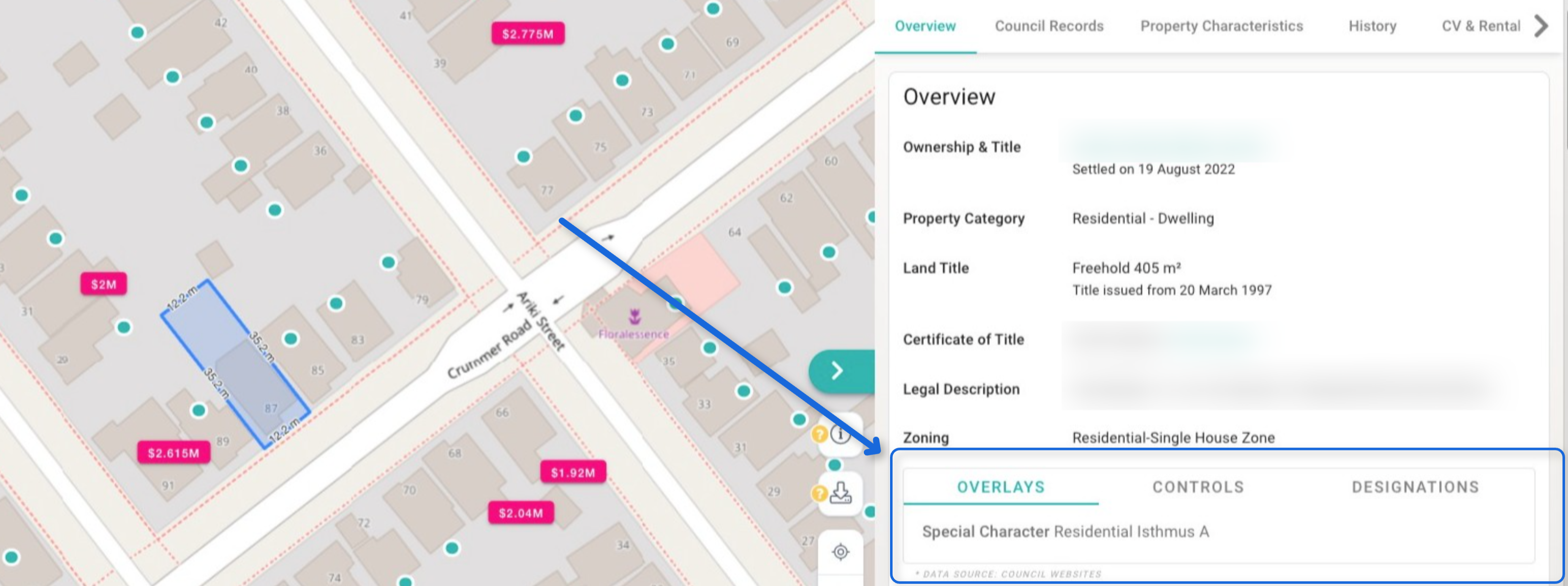
Overlays
Overlays are a layer of planning rules that apply across zones and precincts to manage specific values or resources, such as natural heritage, historic heritage, or infrastructure.
- Function: They generally introduce more restrictive rules than the underlying zone to protect or enhance particular areas.
- Purpose: Overlays are used to address specific planning issues, like protecting significant ecological areas, managing viewshafts to important landmarks (maunga/mountains), or addressing the effects of the National Grid corridor.
- Examples:
- Significant Ecological Areas (SEA) Overlay
- Notable Trees Overlay
- Historic Heritage Overlay
- Outstanding Natural Features Overlay
- Special Character Areas Overlay – Residential and Business
- Stormwater Management Area Control (SMAF) Overlay
Controls
"Controls" is a general term that refers to the various rules and standards within the Auckland Unitary Plan that guide development. These can include Auckland-wide rules, zone rules, precinct provisions, and overlay rules. The application of these controls determines the activity status (e.g., permitted, controlled, restricted discretionary) of a proposed activity and whether a resource consent is needed.
Designations
A designation is a specific planning mechanism used to authorise public works or projects by a requiring authority (like the Council, a government ministry, or a network utility operator) on a specific site, without needing standard land use consent.
- Function: Once a designation is in the plan, the requiring authority can carry out the specified works, though they typically need to submit an outline plan of works to the council for approval.
- Purpose: Designations are used for essential public infrastructure and services, such as roads, car parks, airports, and utilities.
- Examples: Designations for Auckland Transport projects (e.g., specific car parks or road widenings) or the Auckland International Airport.
You can identify the specific overlays, controls, and designations that apply to a particular property using the Auckland Council GeoMaps viewer.